
Weather enthusiasts worldwide tracked the global pressure wave from the massive volcanic eruption in Tonga through Tempest’s network of stations.
A look at three Tempest Weather Stations (Fiji, Hawaii, and California) reporting the pressure wave generated by the Tonga volcano.

An undersea volcano near the Pacific nation of Tonga erupted early Saturday, January 15th, 2022, sending tsunami waves crashing across the shore and people scrambling to reach higher ground. WeatherFlow-Tempest's growing network of Tempest Weather Stations recorded brief spikes in barometric pressure caused by the eruption and began reporting them in real time.
WHAT IS BAROMETRIC PRESSURE?
In its simplest terms, barometric pressure (also known as atmospheric pressure) is the measurement of air pressure in the atmosphere, which is measured by how much weight is being exerted by air molecules on Earth at a given moment. Barometric pressure is a continuously changing metric that will vary based on location and elevation. At sea level, the average barometric pressure is 14.7 PSI, or pounds per square inch, meaning that the air molecules in the atmosphere above are exerting 14.7 pounds of pressure on every square inch below.
The Earth’s atmosphere is often described as a vast ocean of air in which we all live. This analogy allows us to visualize the layers of atmosphere around and above us, which get increasingly less dense until the line between Earth’s atmosphere and space is blurred completely. The changing density of these molecules contributes to the weight of the atmospheric pressure exerted on the Earth, and the reason why humans can't just scale large mountains without acclimatizing to the differing pressure. To explain the pressure wave, one scientist described the eruption as having given, "a little shove or a jiggle to the whole atmosphere.”
A VOLCANIC ERUPTION OF EPIC PROPORTIONS
When a volcanic eruption occurs at the magnitude of the Tonga eruption, it is not uncommon to see a spike in air pressure because it creates a shock wave through the atmosphere. Beyond the ensuing pressure wave, volcanic eruptions can greatly impact the weather and climate since they propel gas, ash, and aerosol particles into the stratosphere, blocking solar radiation. This can result in cooler temperatures for months or even years, depending on the scale of the eruption. In the case of the Tonga eruption, early predictions claim that emissions from the eruption were small enough that experts do not expect there to be a cooling effect.
A volcanic eruption is measured using a classification system called the Volcanic Explosivity Index, or VEI. Developed in the 1980s, it is similar in nature to the magnitude scale for earthquakes. The scale goes from 1 to 8, and each succeeding VEI is 10 times greater than the previous. There haven't been any VEI-8 volcanoes in the last 10,000 years, but humans have seen some powerful and devastating eruptions in our history. Here are three of the largest:
- Huaynaputina | Peru, 1600 (VEI-6). Sitting vicariously along the edge of a canyon, the Huaynaputina volcano eruption is the largest eruption in South American history. The explosion spewed ash over a 20-square-mile area to the west of the mountain that remains today and damaged the nearby cities of Arequipa and Moquengua, both of which took more than a century to recover.
- Mount Thera | Greece, approximately 1610 (VEI-7). Though there is no written record of this volcanic eruption, geologists believe that Mount Thera erupted with the energy of several hundred atomic bombs in just a fraction of a second. There is some evidence that the Minoan civilization living near the volcano knew that it was going to erupt beforehand and evacuated. Mount Thera inflicted severe damage to the surrounding areas by causing tsunamis and creating a cooling effect that dropped the temperatures in the area.
- Krakatoa | Indo-Australian plate, 1883 (VEI-6). A stratovolcano situated along a volcanic island arc, Krakatoa's 1883 explosion caused a tsunami with wave heights reaching 140 feet and killed an estimated 34,000 people. The island on which Krakatoa sat was completely destroyed in the eruption, however new eruptions starting in late 1927 created the Anak Krakatoa, or Child of Krakatoa, a cone in the center of the caldera produced by the 1883 eruption.
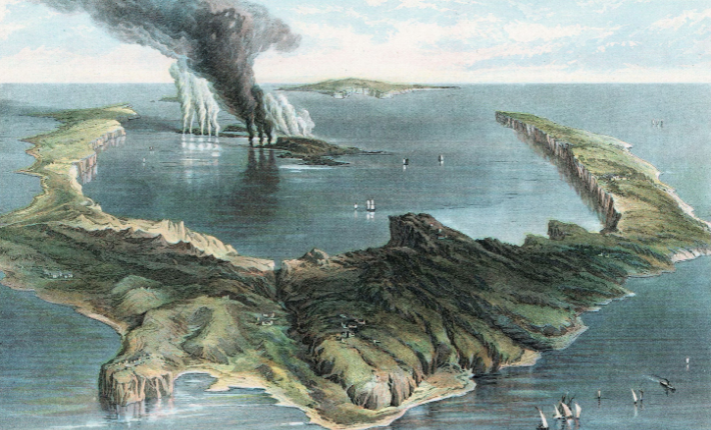 The volcanic island of Thera.
At the time of this article, the Tonga volcano eruption has not been given an official VEI ranking, however early data suggests that it could rank as high as a VEI-5. Some scientists are also comparing the eruption in Tonga to the Pintabu eruption of 1991 in the Philippines, which is a VEI-6. The powerful eruption in Tonga created a tsunami that caused damage as far as the West Coast of the United States and left 3 people dead, in addition to sending ash, fragments of rock, volcanic gas, and steam almost 20 miles into the atmosphere. It also created an atmospheric pressure spike that circled the Earth three times before dissipating, which caused the pressure spike reported by many Tempest Weather Stations.
As one Tempest user noted, “It’s one thing to hear about something happening across the globe, but to see the ripple effect in your own backyard makes it tangible. A great teaching moment!"

Back to: Articles